Digital twinning high voltage powerstations on an approach path
Digital twinning high voltage powerstations
On an active approach path
The Assignment: A complete digital twin for TenneT
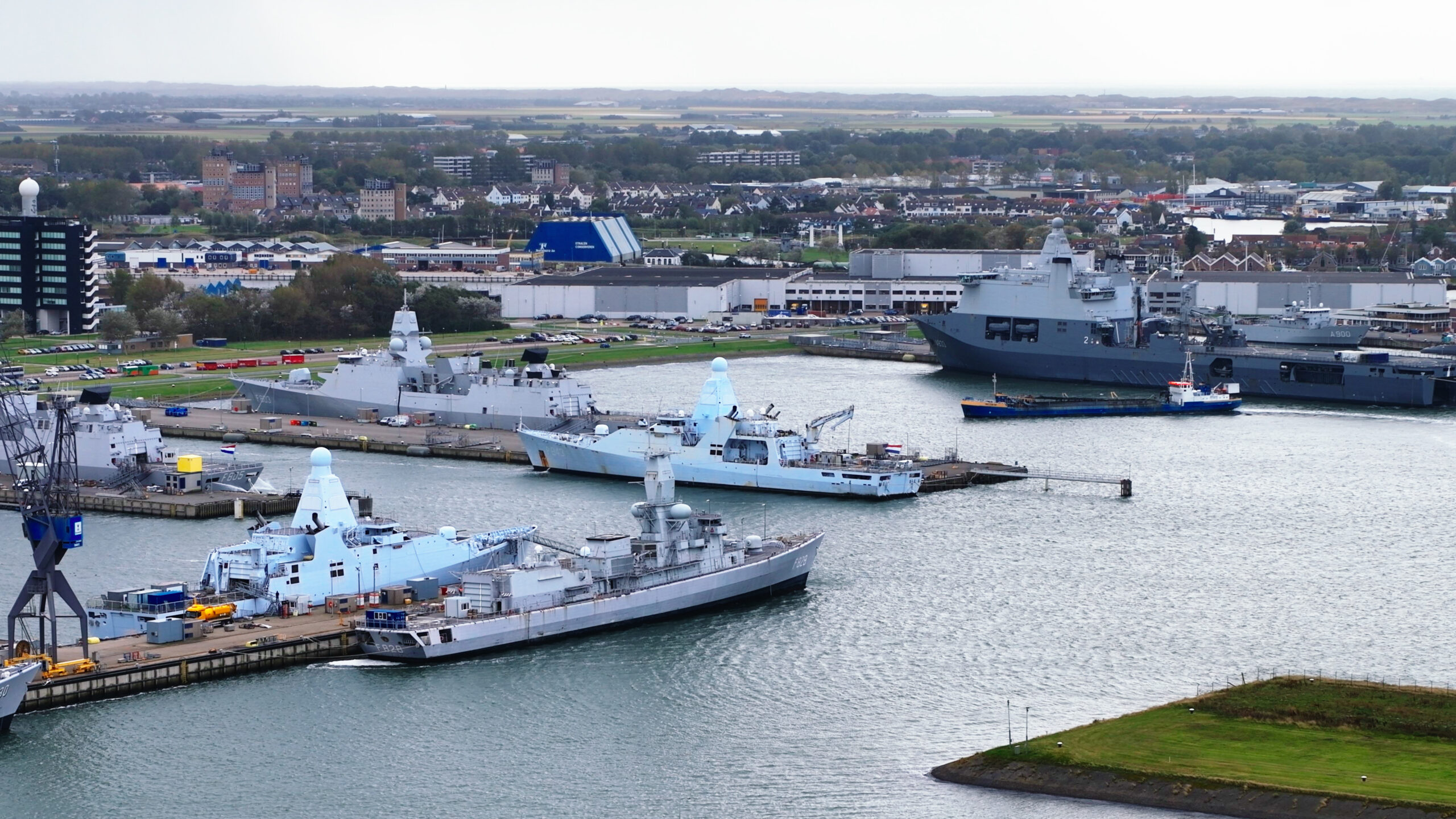
Zero Gravity Drone received a challenging assignment from grid operator TenneT: to fully map an active high-voltage substation using both LiDAR data and photogrammetry. The goal was to create an exact ‘digital twin’ of the installation.
To guarantee the required data density and accuracy, we planned an operation with two separate flight paths:
LiDAR Flight: Executed with the Zenmuse L2 scanner for vegetation penetration and exact distance measurement.
Photogrammetry Flight: Executed with the Zenmuse P1 camera payload for high-resolution imagery and textures.
The Challenge: Policy and Airspace
This project was unique due to a double obstacle we had to overcome:
The Flight Prohibition: Until recently, drone flights over active high-voltage substations were excluded under TenneT’s guidelines due to safety risks. Because this policy was based on older technology, Zero Gravity Drone pushed for a reassessment. We had to demonstrate that our modern equipment is resistant to electromagnetic fields (EMF).
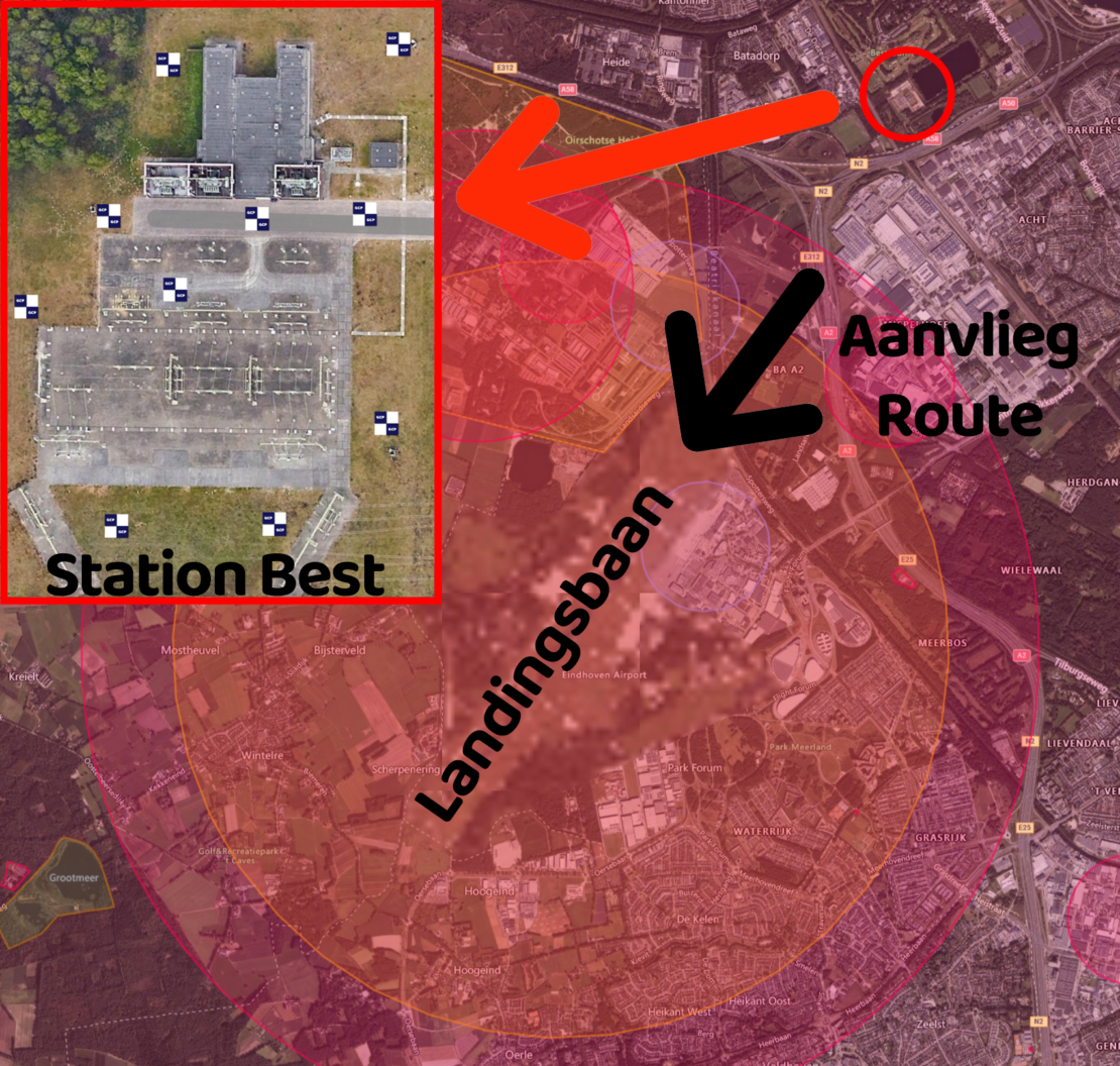
Eindhoven Airport CTR: The location of the substation added an extra layer of complexity: it is situated within the CTR (Controlled Traffic Region) of Eindhoven Airport, exactly under the final section of the approach path (the glideslope) to the runway. This required extreme precision and strict communication with Air Traffic Control (ATC).
The Solution: Preparation and High-End Equipment
Success in these types of complex zones depends entirely on preparation and equipment.
Early Preparation: Months prior to the flight, consultations began with both TenneT and the airport authorities to establish the safety protocols.
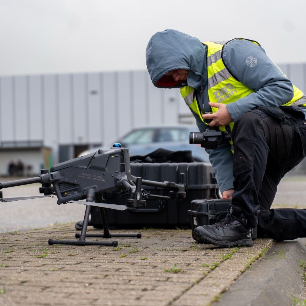
The Technology: We deployed our latest DJI Matrice 400 RTK. This platform is specifically designed to withstand magnetic interference, which is essential when flying above high-voltage infrastructure. Thanks to the RTK module, we were able to fly with centimeter-precision, even in this challenging environment.

The Result
The operation was executed flawlessly. Thanks to the groundbreaking preparation work, the path has been cleared for future inspections. We provided TenneT with a combined dataset:
Razor-sharp inspection photos of the components.
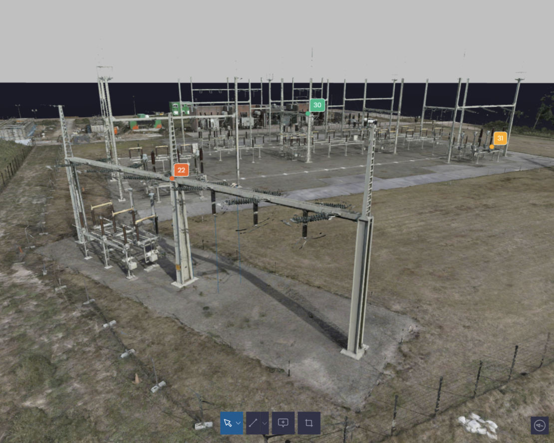
A detailed 3D model (Point Cloud) of the entire substation.
And a LiDAR model in which all measurements between objects can be performed.
With this data, TenneT can perform maintenance assessments and measurements from behind a desk, eliminating the need for technicians to carry out high-risk physical inspections.
More Campaigns

Ready for take off?
We are ready to take off for you.